A while back someone had a heated discussion on our Facebook about whether Hanover was within the boundaries of Adams County PA. There’s not a whole lot of information easily accessible to make it clear, so we decided to set up a simple guide about where the borders of Adams County really are.
Please keep in mind, we love our Hanover, PA neighbors and am happy to adopt them as one of our own here on Gettysburg Wire. Much love to you guys!
In the interest of our ACE Awards, however, we are dedicated to providing an awards program that is for Adams County Businesses. When we count up the valid votes, we’re going to have to make sure we use fair use of a map during the process.
So we decided to provide our research for you guys as well. Not that any of this is particularly interesting, but you guys will see we’re taking the ACE awards seriously 🙂
So what is the Adams County Boundary?
Postal Codes
The current postal codes for real estate purposes in Adams County are:
[one_half]- 17325
- 17372
- 17337
- 17340
- 17303
- 17343
- 17344
- 17304
- 17306
- 17310
- 17350
- 17353
- 17320
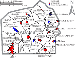
Townships and Boroughs
The Adams County Government website has a list of the Townships and Boroughs in Adams County on their website. These consist of:
[one_half]Boroughs
- Abbottsown Borough
- Arendtsville Borough
- Bendersville Borough
- Biglerville Borough
- Bonneauville Borough
- Carroll Valley Borough
- East Berlin Borough
- Fairfield Borough
- Gettysburg Borough
- Littlestown Borough
- McSherrystown Borough
- New Oxford Borough
- York Springs Borough
Townships
- Berwick Township
- Butler Township
- Conewago Township
- Cumberland Township
- Franklin Township
- Freedom Township
- Germany Township
- Hamiltonban Township
- Hamilton Township
- Highland Township
- Huntington Township
- Latimore Township
- Liberty Township
- Menallen Township
- Mt. Joy Township
- Mt. Pleasant Township
- Oxford Township
- Reading Township
- Straban Township
- Tyrone Township
- Union Township
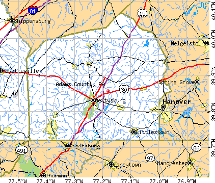
The Available Maps
There are several maps if you search for them that show the borders for townships and boroughs, but they don’t really outline where the border is along the McSherrystown and Midway portion with enough detail. One of them even lists McSherrystown and Midway IN the same boundary as Hanover (Map #2), even though it’s a separate Borough all together.
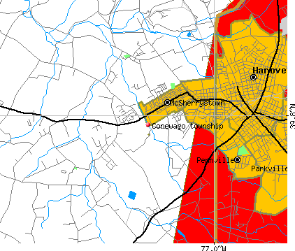
The Google Border Map
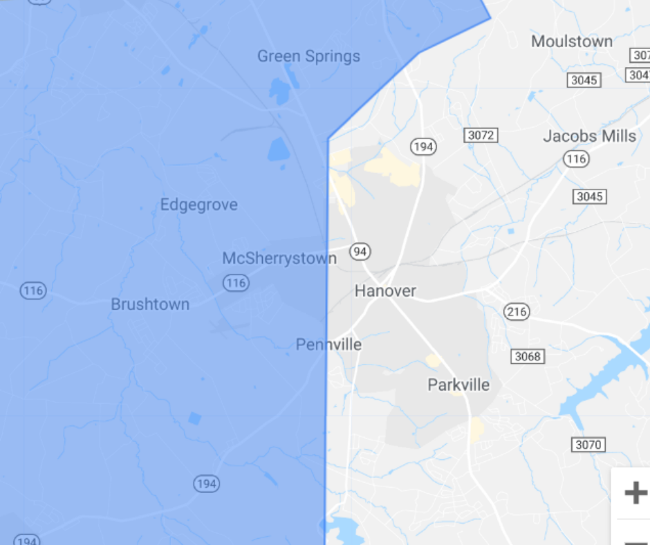
Google has a lot of nifty tools that let you pick out exact areas (well, as much as possible) for marketing purposes, so we’ve gathered some maps that show that the actual border is where McSherrystown and Midway border Hanover and what creates the cut-off between Adams County and Hanover, PA.
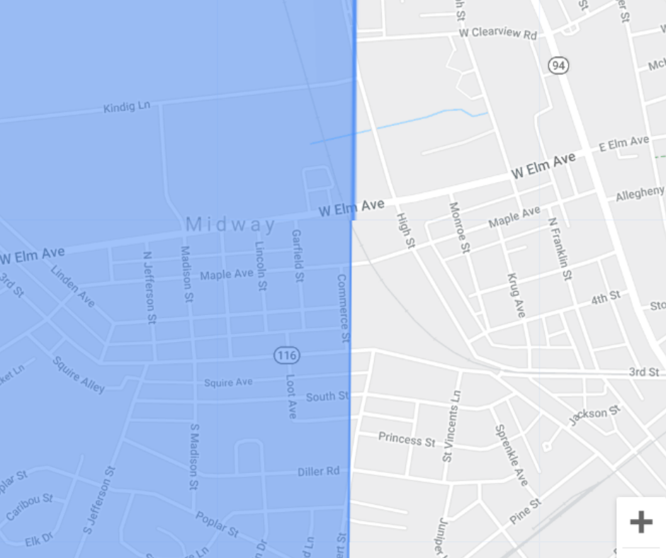
Starting from the entire county outline down to where McSherrystown and Midway Border, and then eventually into where the actual border is on the Elm Street and 116.
It doesn’t look like the border is an actual road or anything like that. Heck, I’m not sure what they constitute as the actual border, but you can get an idea of where the cut-off point is pretty on point below.
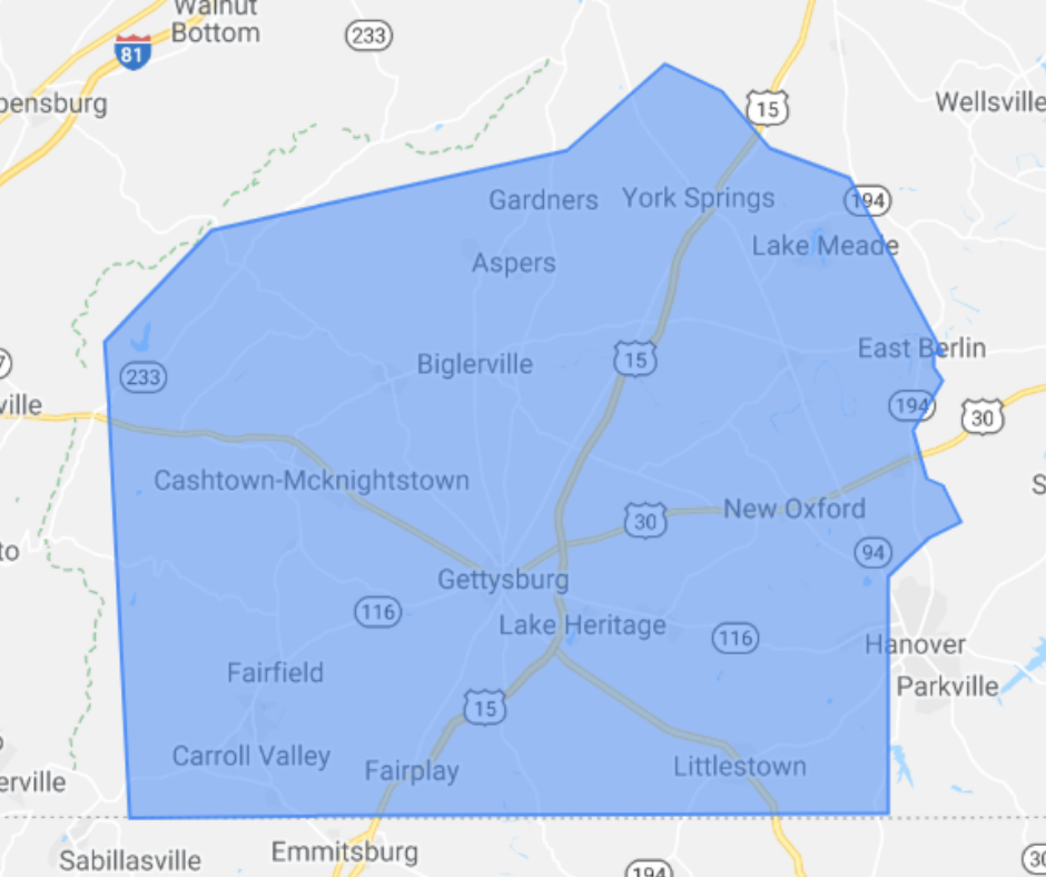
So the blue area is the border of Adams County, PA, and that’s what we’ll be using to validate Adams County Businesses for the ACE Awards for Adams County Businesses, only.
If anyone reads this that has property on the border or that shares the border, let us know! I’m curious to see how your property is categorized and taxed. I know we have the Mary Penn Farm that’s on the border of Maryland and has to pay both state taxes.